
What is a Watershed?
We all live in a watershed!
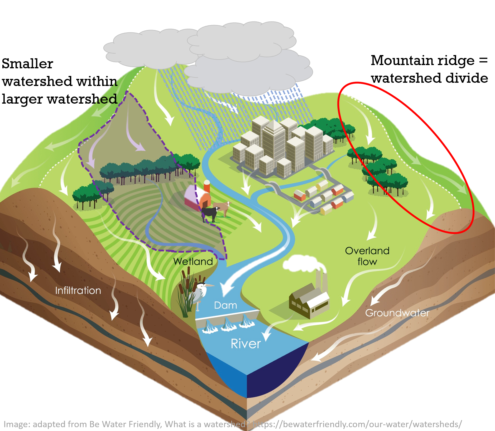
A watershed is all of the land area that drains into the same body of water.
Mountain ridges are watershed divides, there can be multiple smaller watersheds within a larger watershed.
Watershed functions include storing, slowing, and cleaning water.
When healthy, these functions reduce erosion, and increase the stability of land, reduce flood, drought, and landslide risk, and reduce the amount of energy needed for filtration.
Watershed functions are heavily influenced by human actions.
What is Watershed Planning (Watershed Management)?
Goal:
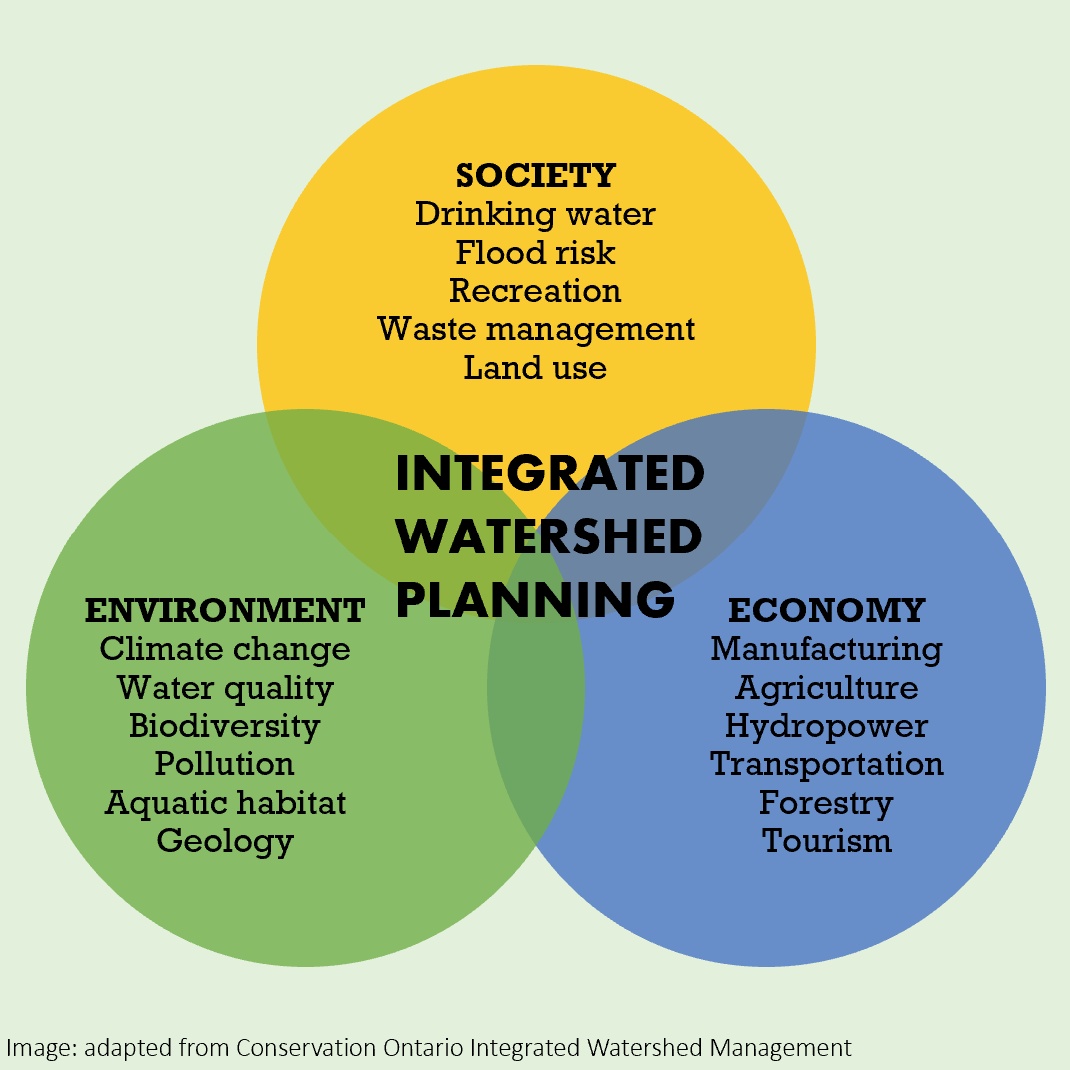
Manage water resources to reduce risks and increase benefits to society (people), the economy, and nature.
How:
Who:
What else?
Watershed planning uses an integrated approach. It considers societal, economic, and environmental needs.
Watershed planning takes many different organizations and people working together to create innovative solutions that work with water to reduce risk to people, the economy, and nature simultaneously.
Why is Watershed Planning Important?
Our coastal region is significantly influenced by water.
Due to climate change, the Pacific Northwest is expected to receive more rainfall, ocean water levels may rise and there are significantly fewer permeable surfaces in our communities compared to 100 years ago.
Climate change is increasing global temperatures. Warmer air temperatures allow more water to be held in the air, creating extreme rainfall events.
More rain, more drought, more extremes. This affects all of us.
Watershed planning employs a diversity of tools to better manage water resources now and into the future.
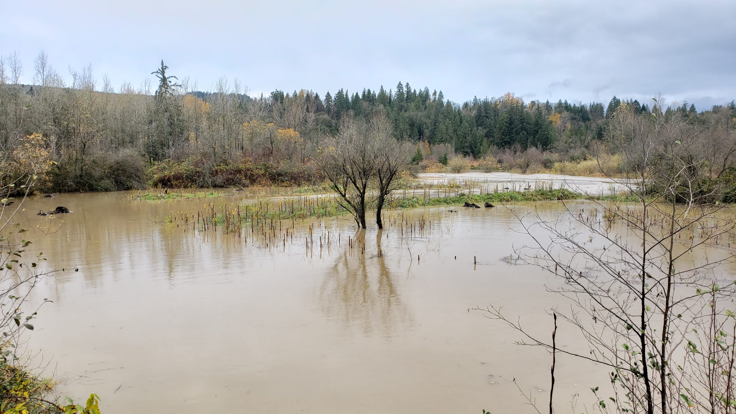
Silverdale West #1 - November 15, 2021, post atmospheric river event. This constructed site of channels and wetlands was made as salmon spawning, rearing, and overwintering habitat. As seen in this photo, it also serves an important role in holding water during high-water storm events and during Fraser River freshet.
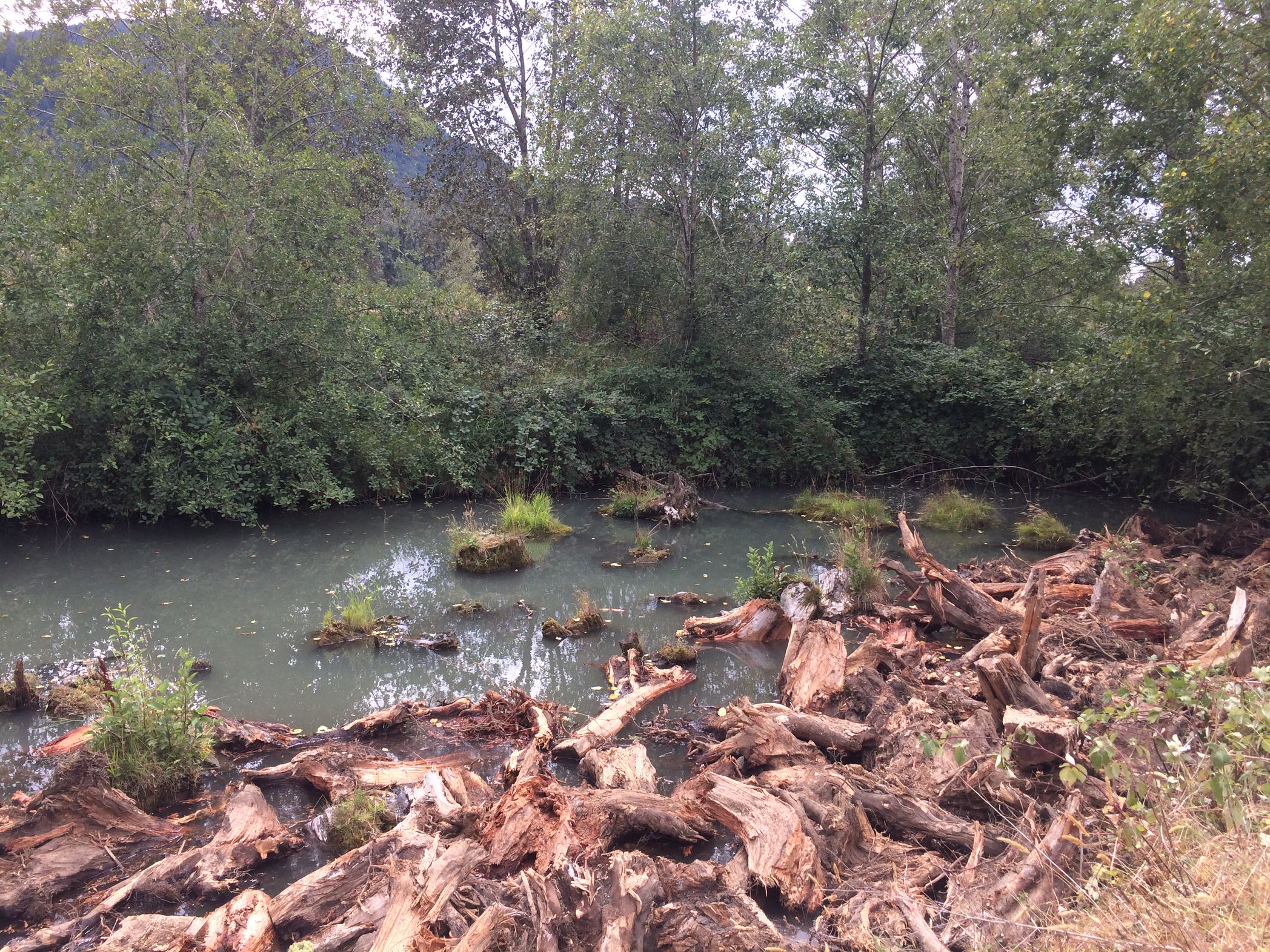
Peach Creek (2017) - Constructed channels on the north side of the Vedder River, Chilliwack, BC.
What is FVWC's Role in Watershed Planning?
We facilitate and identify opportunities to support and create nature-based solutions to watersheds and landscapes - integrating the diversity of landuses and socioeconomic values.
We support activities at variety of scopes: from individual landowner to watershed-level resource managers and planners.
We implement nature-based solutions into our restoration projects and watershed activities.
We contribute to and partner with other organizations to support sustainable and resilient watershed management efforts.
All of which benefits biodiversity and integrates socioeconomic benefits into the area.
Watershed planning employs a suite of tools that can be used to help manage water to reduce risk to society, the economy, and nature.
Nature-based solutions is one of the tools used in watershed planning. Nature-based solutions use a variety of actions and tools to effectively manage natural resources, they work with water to improve watershed functions. Highlighted here are ways to make storage space for water and increase infiltration.
While there is no one-fit-all solution, there are many examples we can explore on types of nature-based solutions that reduce risk and offer benefits to the community, the economy, and nature.
Some examples:
Making More Room for Water
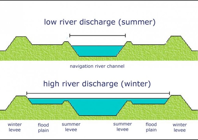
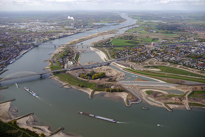
Image: Project of Room for the River (Netherlands). Photo by Johan Roerink. Retrieved from worldlandscapearchitect.com.
Integrating Green Infrastructure
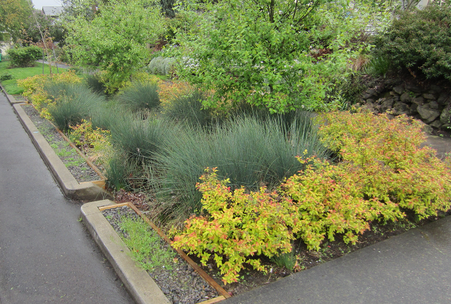
Image: Rain garden, The City of Portland, Oregon, Environmental Services.
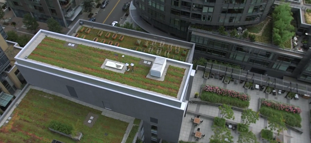
Image: Ecoroof, The City of Portland, Oregon, Environmental Services.
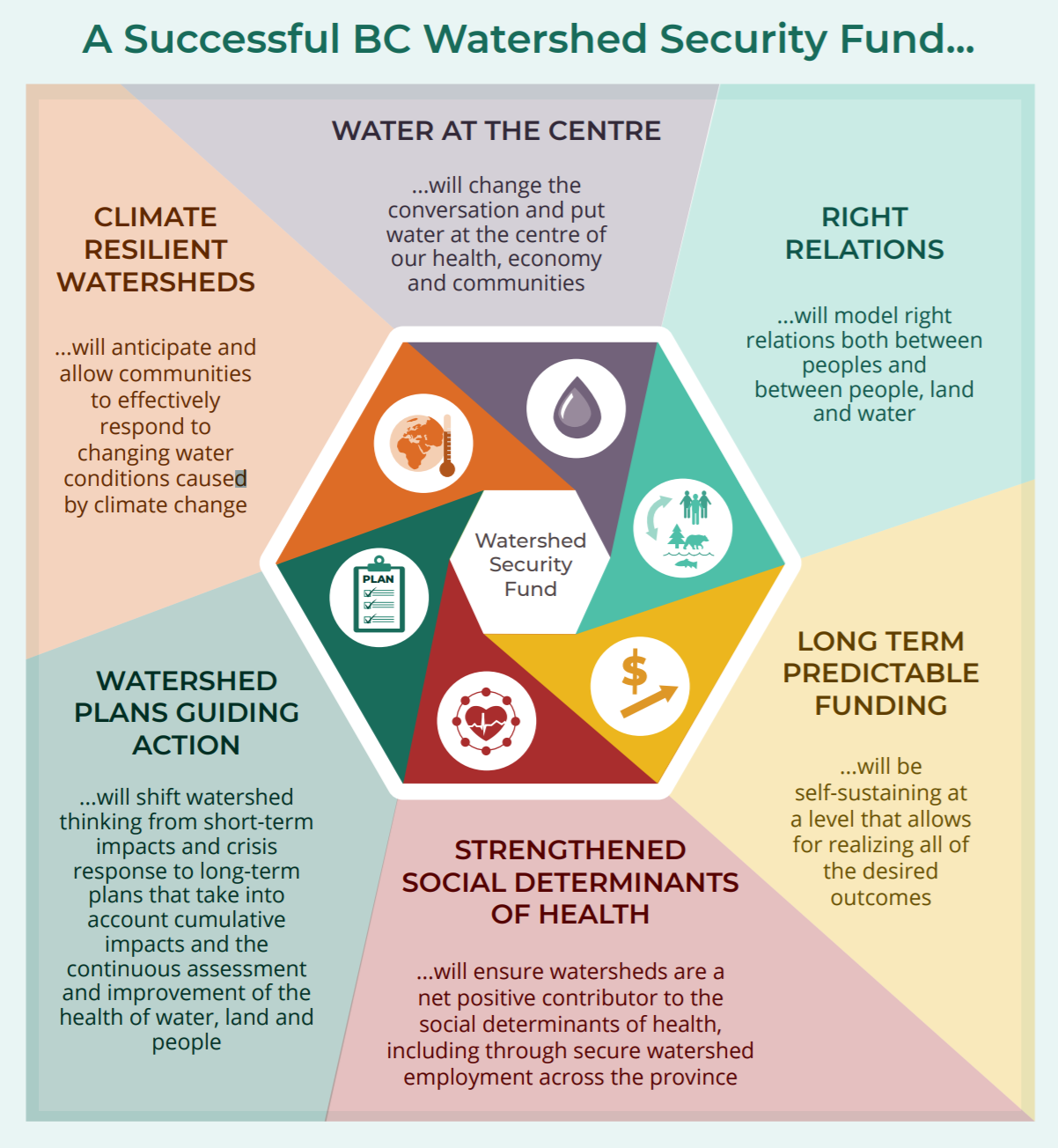
BC Watershed Security Fund: A Collaborative Vision
Indigenous Nations, local governments, watershed groups, and communities have been calling for longterm investments in BC’s watersheds. The BC government has now made a commitment to create a BC Watershed Security Fund.
Released in December 2021, the BC Watershed Security Fund: A Collaborative Vision, is a bold vision for the Watershed Security Fund along with 10 strategic directions that would help make that vision a reality, created by an independent working group of 16 Indigenous and non-Indigenous experts who came together to provide direction on the establishment of the Watershed Security Fund.
This Vision includes key strategic directions to do with: the watershed security fund vision, mission, values, and objectives, funding governance, funding scale and sustainability, funding priorities and criteria, funding for establishing the Fund, revenue sharing options with First Nations governments, approaching the federal government to contribute, and bridging funding from current watershed projects to when the Watershed Security Fund is finalized.
The provincial government is expected to start its engagement process around the Watershed Security Fund in early 2022.
Learn more here:
BC Watershed Security Fund: A Collaborative Vision
BC Watershed Security Fund: A Collaborative Vision, Summary
Netherlands - Room for the River
Italy, Mareit River Restoration
Surrey, BC - Biodiversity Conservation Strategy
POLIS Water Sustainability Project
Conservation Ontario
Portland Watershed Management Plan
Fraser Valley Conservancy
"Close to Home" Program
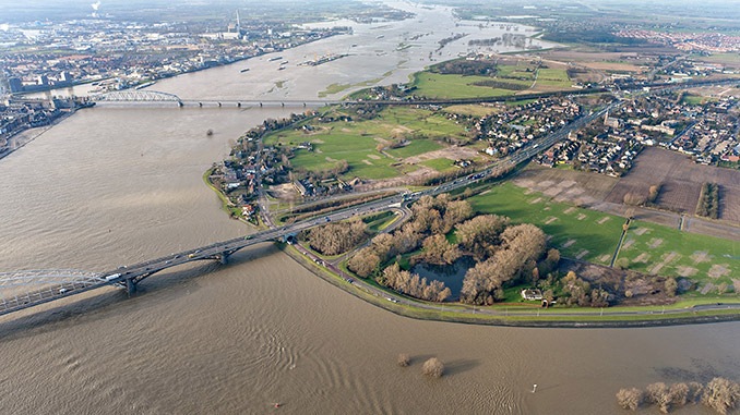
Waal River PRE-RESTORATION
Image: RWS, retrieved from worldlandscapearchitect.com.

Waal River POST-RESTORATION
Image: Johan Roerink, retrieved from worldlandscapearchitect.com.
In 2007, the Dutch government approved a $3.3 billion (CAD) project to protect themselves from flood and erosion risk. The plan included restoration in more than 30 locations throughout the Netherlands. Their goal was to reduce flooding while gaining other benefits, like tourism and recreation areas. Their solution was to make more room for water. Main project areas were completed in 2018, while smaller project areas are still under construction.
In July 2021, Germany, Belgium, and the Netherlands experienced their highest water event since 1911. All three countries suffered tremendous damage and devastation.
The measures put in place by the Room for the River project protected people, community, the economy, and nature. The Netherlands suffered no casualties and the tens of thousands of people preventatively evacuated from their homes were able to return home safely.
Challenges
The Netherlands is 25% below sea level, river flooding has caused devastation for a long time. Their projections revealed that reinforcing the existing dikes would not be good enough to reduce the flood risk. Next, they had to come up with innovative ways to make the rivers safer while having an attractive living environment for the local communities.
Solution
The Netherlands took an innovative approach with the decision to make more room for water. This way the volume of water could flow faster out to sea, reducing the risk of flooding.
How?
Takeaways
The spatial quality of the rivers has been improved and there are more recreational areas, benefiting the local economy. Here are a few of the most relatable points:
To learn more, please visit the reference websites.
References
Interview - The Dutch Make Room for the River. (2018). European Environment Agency.
The Room for the River Program - giving rivers space to roam. (2013). Observatory of Public Sector Innovation.
Room for the River Program. (2019). Netherlands.
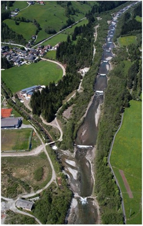
Image: Department of Hydraulic Engineering, Autonomous Province of Bozen-Bolzano, Italy.
Mareit River PRE-RESTORATION (2005)
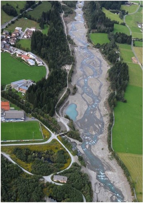
Image: Department of Hydraulic Engineering, Autonomous Province of Bozen-Bolzano, Italy.
Mareit River POST-RESTORATION (2010)
The Mareit River, in the Italian Alpine, was on a degradational trend, with its channel narrowing, bank erosion, and simplification of river route. The area around the river is densely populated and the river had a high flood risk. From 2008 to 2009 parts of the river were restored to reduce flood risk and increase river habitat diversity.
Challenges
Humans greatly impacted the Mareit River in the 19th and 20th centuries. There was a dam built to mitigate flood risk, dikes were built and rebuilt, large amounts of sediment extraction (material to be used in construction), and check-dams were constructed. These actions changed the natural flow and habitat of the river, along with climate change, the river had an increased risk of flooding.
Solution
The solution devised was to make more room for the river.
How?
Takeaways
Restoration to the Mareit River improved structural habitat quality and topographic diversity. The formation of a widened and braided channel while also using dikes represented an optimal strategy to integrate ecological improvements while mitigating flood risk to the densely populated Alpine Valley.
References
Scorpio, V., Andreoli, A., Zaramella, M., Moritsch, S., Theule, J., Dell'Agnese, A., Muhar, S., Borga, M., Bertoldi, W., and Comiti, F. (2020) Restoring a glacier-fed river: Past and present morphodynamics of a degraded channel in the Italian Alps. Earth Surf. Process. Landforms, 45: 2804– 2823. https://doi.org/10.1002/esp.4931.
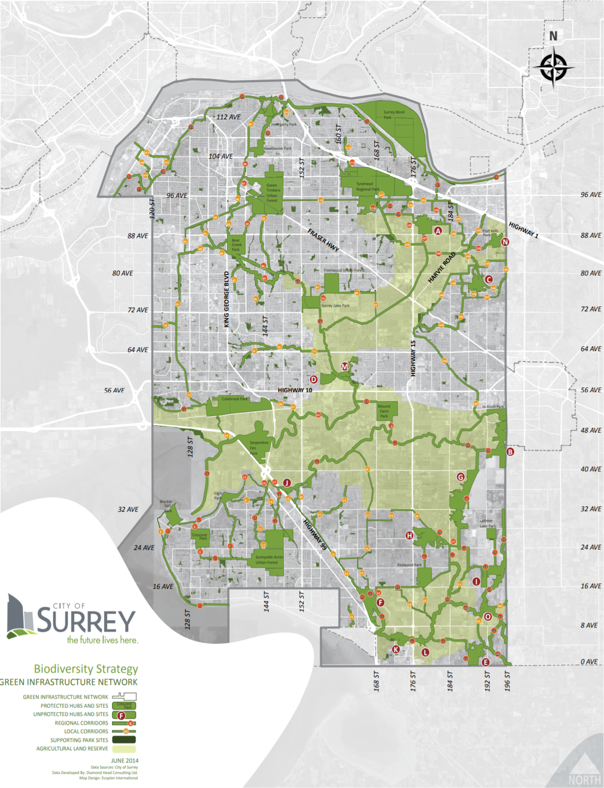
Surrey's Green Infrastructure Network Plan
Surrey’s Biodiversity Conservation Strategy (2014) is a plan to conserve nature in Surrey’s urban environment. Their strategy focuses on the importance of biodiversity for human health, economic and social development, and sustainability.
Driving reasons for the Biodiversity Conservation Strategy:
Challenges
The main challenge Surrey is facing is reduced biodiversity due to habitat loss.
Other challenges to the protection of nature in Surrey include population growth and development pressure, land prices, approved land use plans, Agricultural Land Reserve, land acquisition, planning and development tools, invasive species, climate change, public perception, and human disturbance and interaction.
Solution
Create, protect, and maintain a connected network of green spaces.
How?
Surrey's Green Infrastructure Network - Preserving large core habitat areas, ensuring connectivity between habitat areas, providing a diversity of habitat features. They will:
Takeaways
There are many different approaches to watershed planning, this one focuses on biodiversity. Their integrated approach, large-scale planning, and focus on society, economy, and nature relate directly to watershed planning.
There are challenges to maintaining biodiversity in an urban environment, but with education, policy, and multi-jurisdictional cooperation, innovative solutions can be discovered.
Learn more by clicking the reference links.
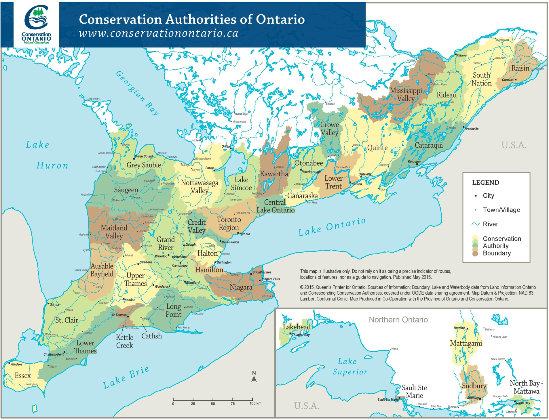
Conservation Ontario Conservation Authority Boundaries
The Conservation Authority boundaries are based on watershed boundaries!
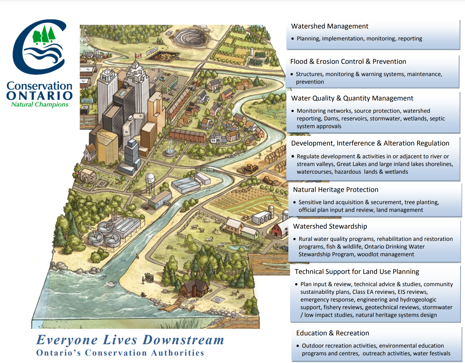
Ontario has a non-profit organization that represents the 36 Conservation Authorities in Ontario. Conservation Authorities are community-based watershed management agencies, that undertake watershed-based programs to protect community, economy, and nature. They apply integrated watershed management practices and focus on reducing flood, drought, landslide, and erosion risk, and conserving natural resources. Conservation Authorities are organized on a watershed basis.
Objectives:
Takeaways
Watershed management can be facilitated province-wide.
Ontario has a structure for the rest of the provinces to use to develop their own province-wide watershed management plans.
Province-wide management ensures that watersheds are valued equally throughout the province. Watersheds are connected and impact one another, it is important to have a unified, and integrated approach.
Learn more from the reference list.
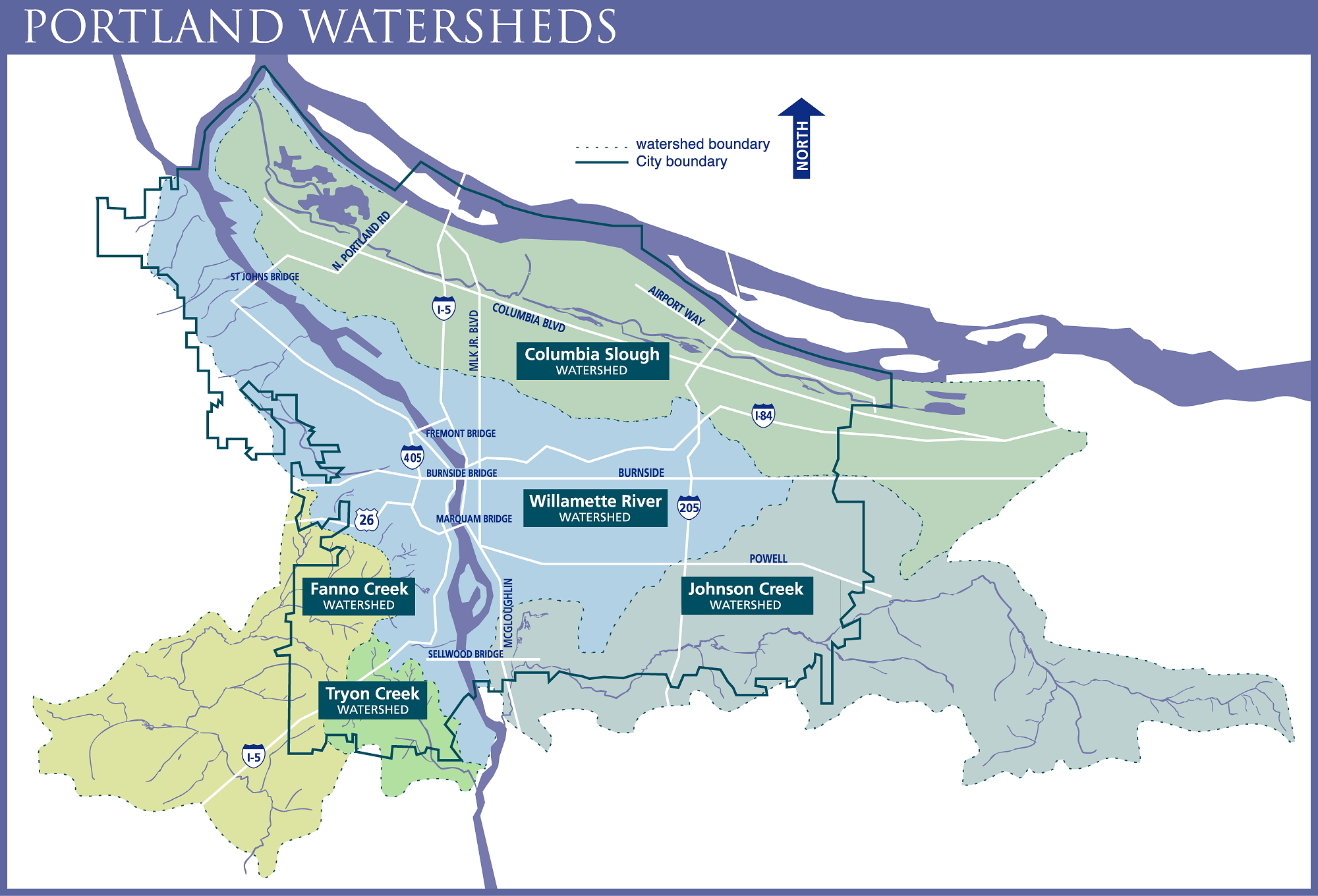
The Portland Watershed Management Plan and The Portland Plan
In Portland, the community and city government believe that healthy watersheds are the solution to many urban problems including stormwater management, flooding, air pollution, and urban heat effects.
In 2008, the Portland City Council made a significant decision to allocate $55 million of the Environmental Services budget over several years to boost the implementation of the Portland Watershed Management Plan, through the Grey to Green Initiative. This management plan has four goals with six strategies on how to achieve their goals. The goals are interconnected, positive action towards one goal will benefit all of the goals.
In 2012, The Portland Plan came out, including a measurable objective on healthy watersheds.
Portland is using a watershed-based approach for city planning. They realize the interconnectedness of land, air, and water, they have found ways to work with multiple jurisdictions and stakeholders, and through adaptive management, they are learning what is working.

Expo Centre stormwater green wall in Portland. Integrating sustainability, art, and science for managing stormwater runoff.

Ecoroofs in The City of Portland, Oregon, Environmental Services.
Challenges
Portland's watershed management plans address these challenges:
Solutions
Portland have many strategies for carrying out their goals. All strategies are planned at a watershed level and often implemented at a local scale.
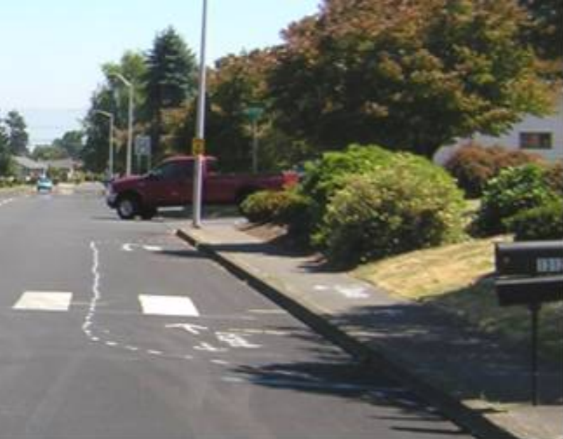
Before green infrastructure.
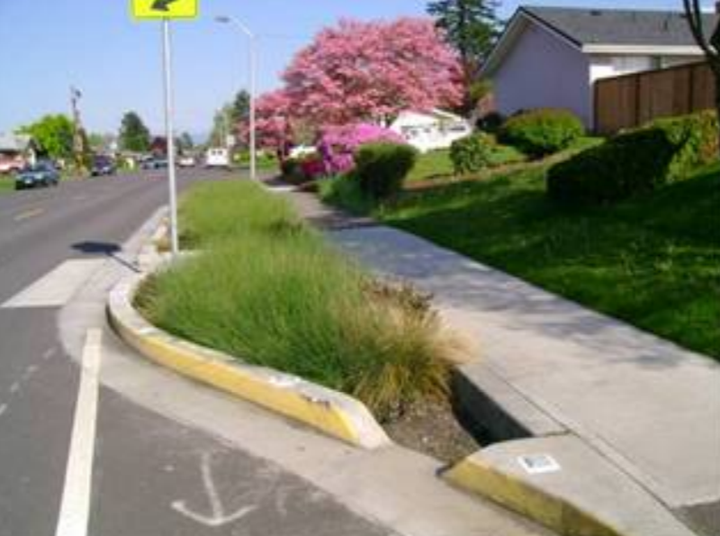
After green infrastructure construction.
Takeaways
Watershed management can be integrated into all levels of city planning.
These plans depend on citywide collaboration, understanding that no single effort can restore watershed health.
There are multiple green infrastructure tools that can control stormwater runoff. These tools can be incorporated into urban development as resources that add water quality benefits and improve liveability.
The Portland Watershed Management Plan considers all activities that affect watershed conditions, they use an integrated approach to meet regulatory mandates. Their approach will restore more natural watershed and stream functions while benefiting society and the economy.
Learn more from the reference list.

Image: POLIS Water Sustainability Project
POLIS Water Sustainability Project
Research - Policy - Education - Action
The POLIS Water Sustainability Project is based out of the University of Victoria's Centre for Global Studies, Victoria, BC. They are an action-based research group focused on developing cutting-edge research and shared solutions, best management practices, and opportunities for reform with those working in environmental sectors. They work with communities, experts, all levels of government, non-governmental, and Indigenous organizations.
Their goal: "drive innovative law reform to generate change towards a sustainable and secure freshwater future"

Image: POLIS Water Sustainability Project
Focus Areas
Highlights
Watershed Security and Governance
The POLIS Water Sustainability Project does research and action towards watershed governance, the reorganizing and focusing of decision-making to better align with watershed boundaries, while addressing watershed health and function, all to enhance social, community, and environmental resilience. They develop concepts with place-based priorities that ensure co-governance and a shared decision-making process are used.
From the combination of watershed governance and the realities of climate change, they have been creating the concept of watershed security.
The foundation of watershed security is the belief that watersheds, in their entirety, need to be responsibly and sustainably managed. To do this, they propose rescaling decisions to ensure better local control and solutions that are fit for communities and nature. They use an integrated framework combining reconciliation, wellness, and the economy for a more prosperous, resilient, and sustainable future.
POLIS releases research on all of their topics, available to everyone. They promote other organizations' research, hold webinars, and keep up to date on all news and provincial developments for all of their topics.
Learn more from the reference list.

Image: POLIS Water Sustainability Project
Fraser Valley Conservancy
The Fraser Valley Conservancy is a not-for-profit organization in the Fraser Valley that works to protect land and water for future generations. Their work includes conservation projects, community outreach, species-at-risk projects, and wildlife reports mapping. Their vision is to be a leader in environmental and heritage conservation through partnerships, education, and action.
"Close to Home" Program
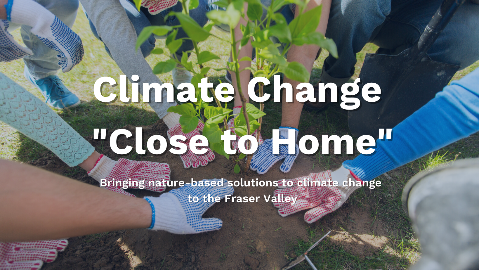
The "Close to Home" Program focuses on the Fraser Valley. It will raise awareness and inspire actions on climate issues to benefit society, community, and nature. This program will increase community action towards curbing climate change by using nature's tools.
There are many ways you can participate in curbing climate change. With this program, the Fraser Valley Conservancy will bring attention to the nature-based solutions you can implement in your neighbourhood to reduce greenhouse gas emissions, build resilient local ecosystems, and store carbon.
Visit their website to learn more and get involved!